|
Bear Rock Falls (middle)
Mt. Washington, MA 430K |
|||||||||||||
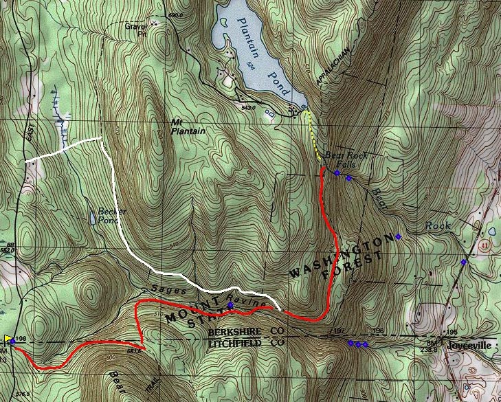
| Some have said that Tannery Falls in Savoy State Forest is the "tallest" waterfall in the state. I'm not sure what the criteria for categorizing Massachusetts waterfalls is. That said the "biggest and longest" waterfall I have seen so far in Massachusetts, has been Bear Rock Falls. The falls are not very well known even as they reside mostly on public land in Mt. Washington State Forest. The main problem is access. Private land with no trail head on the lower end of the falls off Rt-41. Access to the top side requires a lengthily hike from East Street, skirting through Sage's Ravine and hooking up with the Appalachian trail. Once at the top of the falls, which has a magnificent view, access to lower vantage points require one to bushwhack, down heavily wooded, steep slopes with no obvious trail. Boots with cleated soles are recommended, these slopes have 50° to 60° inclines with rock outcrops. I found walking south of the falls 150 yards and then dropping down slope found less bramble and fewer obstructions to contend with. | |||||||||||||
|
GPS Coordinates
42° 03' 42" NN.....73° 26' 06" W Elevation 1102 ft. above sea level Access Difficult to access due to posted property or parking bans. Town of Mt. Washington has strict enforcement for violation of ignoring no parking posting. In any event, you can get there, see below for directions. Camping and fires are permitted nearby on the the Appalachian Trail on Laurel Ridge, but check for seasonal fire permission with Massachusetts Fish and Games or Massachusetts Department of Conservation and Recreation. No camping permitted above falls, restoration of area in progress. Swimming is not applicable. |
|||||||||||||
 |
|||||||||||||
|
|
|||||||||||||